1. Introduction
The Precision Race Levelling Challenge was conducted as a hands-on learning activity for first- year BTech Civil Engineering students. The primary objective was to develop their practical skills in levelling using surveying instruments while fostering teamwork and time management. This activity provided students with real-world exposure to fundamental surveying techniques essential in civil engineering projects.
Levelling is a crucial component in surveying that determines the relative heights of different points on the Earth’s surface. Accurate levelling is essential for various civil engineering applications, including road construction, drainage systems, and structural foundations. This challenge aimed to instill a strong foundation in surveying practices among students.
2. Objective
The main goal of the challenge was to enable students to:
- Understand and apply the principles of levelling.
- Gain practical experience in setting up and using levelling instruments.
- Improve their accuracy in taking staff readings.
- Work efficiently as a team under time constraints.
- Develop observational skills and analytical thinking in a field environment.
- Learn the importance of precision and systematic data recording.
3. Activity Overview
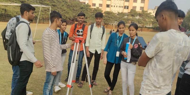
- Formation of Teams: Students were divided into multiple teams, each consisting of minimum 4 members.
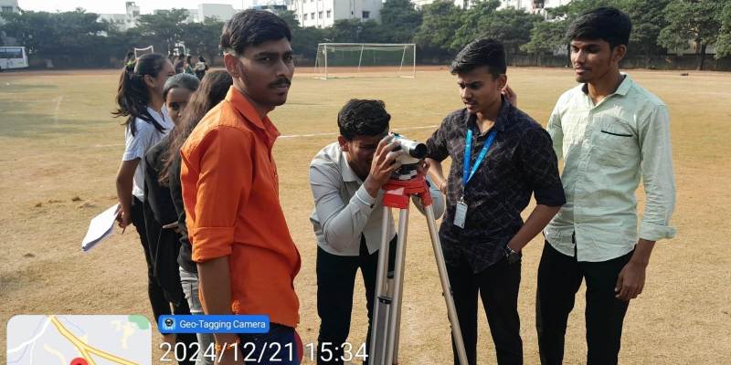
- Equipment Provided: Each team was equipped with a levelling instrument (Dumpy Level or Auto Level) and a levelling staff along with distance meter.
- Task: Each team had to correctly set up the instrument, take staff readings, and record the readings with precision.
- Evaluation Criteria: Teams were judged based on accuracy and the time taken to complete the task.
- Winning Criteria: The team that successfully completed the task with the highest accuracy in the least possible time was declared the winner.
- Faculty Supervision: Faculty members supervised the activity to ensure correct procedural implementation and assist in troubleshooting.
4. Execution of the Activity
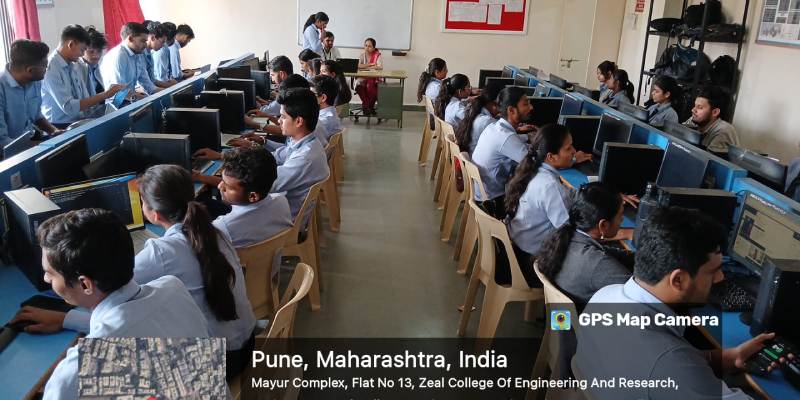
1. Orientation Session: The activity commenced with an orientation session where students were briefed on the proper use of levelling instruments, standard procedures, and safety measures. Faculty members provided live demonstrations of setting up the instrument and taking accurate readings.
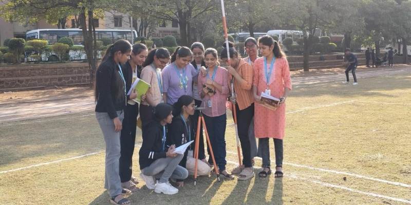
2. Team Setup & Instrument Adjustment: Each team was assigned a specific location where they had to set up the instrument following correct levelling procedures, including tripod placement, instrument balancing, and checking bubble levels.
3. Taking and Recording Staff Readings:
- One team member acted as the instrument operator, adjusting the level and taking readings.
- Another member positioned the staff at marked points to obtain elevation readings.
- A third member recorded the observations accurately in a field book.
- Fourth member recorded the distances from benchmarks.
4. Verification & Error Checking: Teams were required to cross-check their readings to minimize human error. Faculty members reviewed recorded data and provided feedback on inconsistencies, if any.
5. Time & Accuracy Assessment: Upon completion, time taken by each team was noted, and accuracy was verified by comparing results with standard benchmarks.
5. Results & Winner Announcement
After thorough evaluation, the winning team was announced based on:
- Accuracy of Readings: Minimum deviation from expected values.
- Time Efficiency: The team that completed the task in the shortest duration without compromising accuracy.
- Teamwork & Coordination: Effective collaboration among team members.
- Error-Free Documentation: Properly maintained field book records.
6. Learning Outcomes
- Students gained hands-on experience in using Dumpy and Auto levels.
- Improved teamwork, communication, and decision-making skills.
- Enhanced understanding of field challenges and real-world surveying applications.
- Learned the importance of accuracy and efficiency in civil engineering tasks.
- Developed problem-solving skills by identifying and rectifying common levelling errors.
- Understood the impact of environmental factors on surveying measurements.
7. Challenges Faced & Solutions
Challenges:
- Difficulty in setting up the instrument on uneven terrain.
- Miscommunication among team members leading to inaccurate readings.
- External disturbances such as wind affecting staff stability.
- Time constraints creating pressure on students.
Solutions Implemented:
- Teams were guided on how to stabilize the tripod on rough surfaces.
- Proper role assignments within teams ensured clear communication.
- Techniques for holding the staff firmly in windy conditions were demonstrated.
- Time management strategies were discussed before the challenge.
8. Conclusion
The Precision Race Levelling Challenge was a successful and engaging activity that reinforced the fundamental principles of levelling in civil engineering. The students actively participated and demonstrated a keen interest in improving their surveying skills. Such practical exercises are essential in bridging theoretical knowledge with practical application, preparing students for professional challenges in the field of civil engineering.
9. Future Recommendations
- Conduct periodic levelling exercises with increasing complexity.
- Introduce competitions at inter-college levels for broader learning exposure.
- Implement digital surveying equipment to familiarize students with modern tools.
- Organize industry expert sessions to provide real-world insights.
10. Acknowledgment
We extend our gratitude to the faculty members, organizers, and student volunteers who contributed to the successful execution of this event. Special thanks to all the students for their enthusiastic participation.